Showing posts with label aerial photography. Show all posts

Monday, March 7, 2011

Cities from the Sky, Part Three

This is the third part in a series about aerial photography and the built environment. If you missed part one, click here, or part two, click here.

So far in this series I've written about Christoph Gielen, a photographer who uses aerial imagery of suburban development to make commentary on current urban design paradigms. I've also brought you into orbit and introduced you to astronaut Don Pettit who took you on a global tour of cities at night. But in this third (and likely final) post in this series, I'm going to take you closer to home. My home, that is.
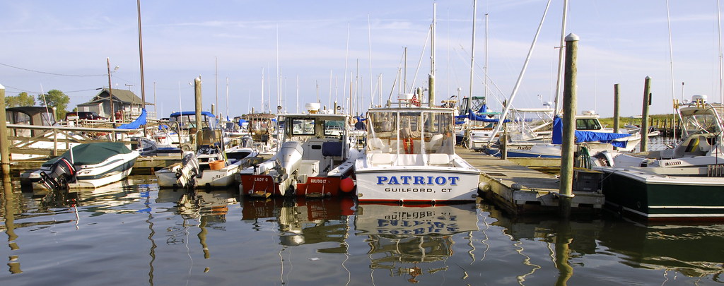


Guilford, Connecticut is a small town 14 miles east of New Haven on the shore of Long Island Sound. Founded in 1639, the town is host to hundreds of historic homes, a variety of natural amenities including beaches and wetlands, rolling hills and bluffs, and is also characterized by a community ethic of preservation and conservation that protects these assets.

If you've taken an urban studies class with me, you should be familiar with Guilford. It is a usual topic of mine for projects, papers, and presentations. For example, I've written on the history of the Town Green, one of the largest in New England, I've profiled Guilford's Plan of Conservation and Development, a model document for land use planning, and I've written about Guilford's effort to block a proposed Costco development at exit 57 off of Interstate 95.
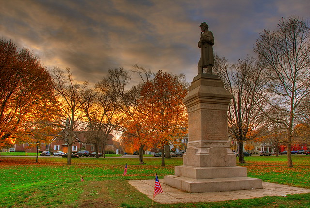


But how does Guilford fit into the theme of this series?
In the late 1990s, renowned urbanist, author, and Yale professor Dolores Hayden took to the air with photographer Alex MacLean to document what they refer to as Guilford's cultural landscape. They define this idea as a "broader way of analyzing architectural, economic, and environmental forces together, to look at how a society shapes its space over time." Where preservationists, planners, and conservationists examine at each of these elements individually, this approach produces a more comprehensive look at how they interact.

In a companion essay to their aerial portfolio (also a great history of development in Guilford),
they describe the role aerial photographs play in capturing cultural landscape in a detailed and accessible way:
Aerial images can capture the preserved parts of a town's cultural landscape, and can also help identify the threatened parts and the shape of land use conflicts, present and potential. Low-level, oblique-angle pictures of many parts of the town can establish a more complete visual inventory than ground-level shots. They can show inaccessible places, such as wetlands or steep terrain. They can reveal usually hidden sites, such as dumps or gated communities.... They convey the vast scale typical of twenty-first century development, and can bring up-to-the-minute data on the progress of sprawl. And, best of all, they are understood by people without technical training, in a way that zoning maps, zoning codes, satellite surveys, and traditional site plans are not.
Let's take a look at some of their photographs.


We'll start off with the most important landmark in Guilford, the Town Green. The green serves as the central gathering space for town events including high school graduation, an annual handcrafts fair and other cultural events, town parades, and dozens of other community functions. The retail, municipal, and religious institutions lining the green also make it the nexus of activity in Guilford.


Do you notice anything interesting or odd about the image above? Route 1, the road running horizontally through the center of the picture, is also the dividing line of one of Guilford's historic districts. Just look at the difference in the (somewhat) dense neighborhood of old homes and the asphalt of the shopping center across the street. Bonus question: Can you find the octagon-shaped house?


Finally, the completion of Interstate 95 through Guilford in 1958 brought about a population explosion that would change the town forever. More people meant an increased demand for housing, and developments like the one above sprung up throughout town, mostly in the wooded areas north of the highway.

To see the rest of the aerial portfolio, click here.

Hayden and MacLean conclude their commentary with the following: "In 1935, the architect Le Corbusier wrote, 'The airplane indicts.' He claimed that anyone flying over old French towns would see the need to tear down and rebuild to his modernist designs. We suggest the opposite. Aerial photography with a hand-held camera heightens awareness of unique cultural landscapes by documenting land use in an accessible way.... They can help architecture buffs and environmentalists, citizens and specialists, visualize common ground."

This vision of the common ground is what I find so striking about these images, and what I hoped to share with you.
Guilford is a place I very much admire - in many ways my experiences growing up there set me on my current path of study and it seems only fitting that I return to it now as an example community for questions regarding urban development.

Monday, February 28, 2011

Cities from the Sky, Part Two


This post is the second in a series on cities as seen from above. If you missed part one, click here.

Cities at night are as wondrous as they are mysterious. With the setting of the sun, cities transform into entirely different entities. Just think about the varied experiences of walking down a street while the sun is shining and then again after dark. But how does this experience change if these cities are seen from above? And I'm not talking about just aerial photography this time.

In the following video, astronaut Don Pettit takes us on an orbital tour around the world of cities at night. He explains the challenges of capturing such clear images from space, as the International Space Station travels around the globe at over 17,000 miles per hour. Try going that fast and capturing a high-resolution, blur-free image from your point and shoot. It's not going to happen. But Pettit and his colleagues on the ISS assembled a sophisticated mechanism that cancels out orbital motion and produces the clear, striking images you see here:


Pettit's admiration of human settlement patters comes through in his commentary. His most insightful observation is that "Cities at night are caught in a triangle between culture, geography, and technology." These elements influence everything from a city's color and brightness to its geometry. Just as cities shape our actions, experiences, and quality of life, so too do we influence the forms our cities take. In part one of this series, I made the point that cities from the sky are works of art, and Pettit shares this sentiment: "We do not construct our cities by how they might look from space. Cities at night may very well be one of the most beautiful, unintentional consequences of humanity."

This next video will bring us down to earth, quite literally. Shot from the nose of a commercial airplane, we are escorted to the tarmac during its final descent into LAX. As the sun sets and the plane travels closer and closer to its destination, we get a unique look at the City of Angels. Enjoy:

Monday, February 7, 2011

Cities from the Sky, Part One


We all know what cities look like from the ground. They are the spaces in which we live, work, and play. But there is another view of cities that we rarely experience, and one that can help form impressions of the places we inhabit: from the air. Photographer Christoph Gielen has taken it upon himself to critique the predominant American urban form, the surburb, from this very vantage point.

Take a look at some of his photographs (click on them for a closer look):


Let me ask you a question, are these neighborhoods or works of art? The last two images especially, with the integration of the water bodies and the curving features, suggest the latter. Sure, I've been harping on the aesthetics of cities quite a bit in my most recent posts, but I can't help it. I know you see or feel some aspect of what I do. Learning to "read" cities, from the ground and the air, is exciting. A deeper understanding of your surroundings deepens your connection (or aversion) to that place.

But let's move in another direction for a moment. The argument can be made that cities from above tell us very little about what it actually means and feels like to live in these locations on the ground. I would agree with this point. But the fact remains that when these aerial views are paired with knowledge of what life is like in these places, undeniable truths about patterns of urban settlement are revealed.

I think the following picture illustrates this point particularly well:


A few things should jump out at you immediately. The desert, for one. The mountains would also be a good guess. But if you look at it more closely you will see that there are only two points of access, and both of them feed into the collector road to the right. You'll also notice a pretty bizarre street layout. The network of loops and cul-de-sacs makes a better labyrinth than it does a connected, walkable neighborhood. Not that there's anywhere to walk to, of course. So yes, I have never been to this development, but its aerial signature nevertheless tells me something about it.

Gielen himself hopes that this method of reading of the urban landscape will help guide development decisions in the future. In this New York Times article, he says "As with all my work, I was interested in finding a formal perspective uncommon enough to startle viewers into a reconsideration of our built environment."

To see Gielen's full portfolio, check out his website.